Uwharrie Field Guide
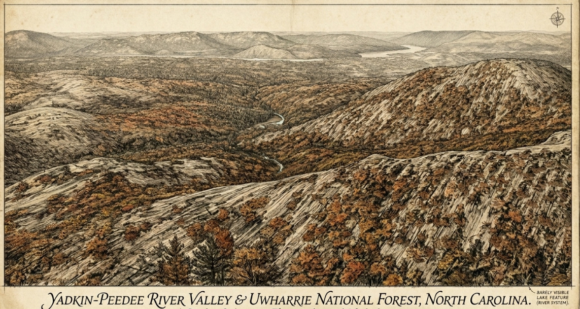
The Yadkin begins in the Appalachian Mountains, weaving its way through Elkin before reaching the Yadkin Project. At the Badin Narrows, the river cuts through the resistant metavolcanic spine of the Uwharries, then converges with the Uwharrie to create the Pee Dee.
Nine sections, each cited to a primary source. Values that go stale — daylight, declination, season and closure status — are computed when you open the page.
The corridor
Feature index
Field orienteering — the trail corridor, sheet by sheet
Operational picture
Where you are
Why everything happened here
The topography is not incidental. The Uwharries are erosional remnants of resistant metavolcanic rock — the surface expression of a latest Ediacaran to early Cambrian volcanic arc — and the river has had to cut through them rather than around. That single fact explains the rest of this atlas:
- the river narrowed and fell through a gorge, which is why the dams are here;
- hydrothermal gold-bearing quartz veins in the same arc rocks weathered into the valley gravels, which is why the placers are here;
- fine-grained metavolcanic stone with conchoidal fracture outcrops on the ridges, which is why the quarries are here and why Uwharrie stone travelled hundreds of kilometres;
- thin dry soils on the ridges and moisture-holding joints in the slate below produce a vegetation mosaic you can walk across in one pace.
Geology
Half a billion years of arc volcanism, quiet-basin mud, one continental collision, and a very long weathering. Select a unit to read it.
Five things worth getting right
Hydrology
Almost none of the water surface visible from Morrow Mountain is, strictly, river. It is six engineered pools in under forty river miles, on two federal licences, both expiring on the same day in 2055.
The cascade
The Narrows
Flood record
Water quality on this reach
Classifications are from the NC Division of Water Resources Yadkin–Pee Dee basin classification schedule. WS = water supply, B = primary recreation, C = aquatic life and secondary recreation, ORW = Outstanding Resource Waters, CA = critical area of a water-supply watershed. Bioclassifications are benthic macroinvertebrate and fish-community ratings from DWR basinwide assessment sampling; a water can carry a use classification and never have been biologically sampled.
Ecology
The Forest Service manages this landscape as eleven ecological systems, each with a canopy target and a fire return interval.
Reading the slope
One traverse from a sheltered north slope up over a metavolcanic ridge and down a hot south face crosses most of what is here. Select a position.
Species of record
Presence codes: on this reach — documented here; basin only — occurs in the Yadkin–Pee Dee basin but not on this reach; downstream only — survives below Blewett Falls; absent — named in planning documents but not present; introduced — established but not native; uncertain — sources conflict.
Woody flora — the dendrology list
Priority tiers follow the course's own three-way split. On the Uwharrie marks a taxon named in the 2012 Land and Resource Management Plan's characteristic-plant list for that ecological system — select any system on the cards above to read its full list. Etymologies are the course's.
Management
The longleaf gap
Against a desired seven and a half thousand acres, the forest has moved from 2,300 acres at the 2010 inventory to 3,517 assessed in the FY2020–22 cycle — real progress, and less than halfway. The desired condition carries no completion date. The 2012 plan's fifteen-year restoration objective was 4,500 acres across all systems, at 100 acres of longleaf planted per year.
Condition of the longleaf that exists
Objective against accomplishment
Sources are the Forest Service's own biennial monitoring and evaluation reports for FY2016–17, FY2018–19 and FY2020–22. Where a row reads not reported, the objective exists in the plan and no corresponding Uwharrie figure appears in any published monitoring cycle. The FY2020–22 report, published May 2024, is the most recent; nothing has been published for FY2023 onward.
History-Demographics
Twelve thousand years of people living here, two centuries of mining and milling, a century of the river under dams, and a written record that kept better track of the companies than of the people who worked for them.
The county the forest sits inside
A population that peaked in 2010
Where the land economy sits
The mills, and what followed them
The trade-adjustment record
One county, two settlement patterns
The towns differ from one another
The county alongside the state, indicator by indicator
Every row is Montgomery first, North Carolina second. Both figures are printed so they can be read against each other. Where the county sits ahead of the state the row is marked better; where the two are the same, level. Vintages differ by indicator and are given in the sources below; these are not all the same year and should not be read as a single snapshot.
A quarter of the houses are second homes
The tax base and the tier formula
Reading the American Indian figure
What these numbers do not settle
Five gaps, stated rather than papered over. In each case the figure exists somewhere and could not be retrieved from an accessible source; none has been replaced with an estimate.
What the record does not hold 3 Three absences that shape everything above.
Three absences that shape everything above, and that rhyme with the cartographic gap set out under Sheets: this valley was repeatedly acted upon before anyone was required to write down what was there.
Nothing was surveyed before the water came
Narrows, Falls, High Rock and Tillery all closed before any legal framework for salvage archaeology existed — the Reservoir Salvage Act dates to 1960, the National Historic Preservation Act to 1966. Coe reached this valley in 1937 at Town Creek and 1948 at Hardaway, twenty to thirty years late. The sites that made it famous are the ones that happened to sit above pool: Hardaway on the hill, Doerschuk below Falls Dam, Lowder's Ferry on the Tillery shore. Whatever occupied the floodplain and terraces inside the gorge went under unrecorded. The one documented human trace of the drowning is a cemetery relocation — burials moved between 1915 and 1917 onto high ground that became Graveyard Island when the lake rose.
Town Creek: cultural affiliation and repatriation status
North Carolina Historic Sites states that the people who lived at Town Creek "remain culturally unaffiliated with historic tribes like the Catawba, Lumbee, or Cherokee." Under that classification no repatriation has taken place. Remains from more than two hundred burials are curated at UNC–Chapel Hill, which holds the state's largest unrepatriated collection, and the site's published interpretation does not address NAGPRA, tribal consultation or descendant communities. These are the agencies' own positions as published; this atlas records them rather than adjudicating them.
The mining workforce in the record
Jeff Forret's 1999 study in the North Carolina Historical Review is the standard account of labour in the state's gold fields, and documents enslaved workers as central to the industry from John Reed's operation in 1803 onward; Cornish miners brought hard-rock technique as the placers gave out. What the surviving record preserves, however, is plant and corporate paperwork — the Library of Congress holds fifteen photographs and eight measured drawings of the Coggins stamp mill at Eldorado alone. Individual workers appear in it almost entirely as aggregates.
Conditions
What to do with all of this while standing in it.
Monthly normals
Season, heat, water and zone
Figures are NOAA 1991–2020 normals for Albemarle unless noted. These are the numbers that decide a burn window, a planting date and whether a creek will be running.
What has actually changed
The valley's own weather
Regional normals describe the Piedmont. They do not describe this valley, which makes three of its own corrections to them.
A boulder in hand
The xeric ridge spine between Dennis Mountain and Lake Tillery carries resistant float boulders of laminated Tillery Formation slate: mottled grey-blue, lichen-crusted, parallel wavy laminations, rusty iron-oxide streaks from weathered pyrite, a faint sparkle of recrystallised mica. Many rest close to the gradational contact with the Uwharrie metavolcanics beneath.
That contact is not academic. The Tillery holds moisture in its bedding-plane joints; the Uwharrie-derived sandy loams weather thin and dry. The vegetation change you can cross in a single pace on that ridge is bedrock speaking directly to biology — and it is the clearest thing to show anyone who thinks geology is a separate subject from ecology.
Leave the boulder where it is. Ten pounds of loose surface specimens is the personal-use limit, and none of it applies inside the Birkhead.
Rules that actually bind
A reading aid, not legal advice. The Code of Federal Regulations, the forest's own orders and the Uwharrie Ranger District govern; where this summary and a posted order differ, the order is correct. Rules change without notice and some are seasonal — check the forest alerts page before you rely on anything here.
Sheets
Cartographic documentation & compiled sources
Every sheet below is held by a public institution and viewable in that institution's own reader. One is reproduced in full — the 1963 Forest Service plate, which is public domain.
Plate I — Uwharrie National Forest, 1963, revised 1970
Live services — terrain, remote sensing and field intelligence
Every URL checked September 2026. A caution block records what the tool will not tell you on this landscape — usually the more useful half, and the reason several of these are routinely misread. Four services in this list have moved or been discontinued since the first edition, and the old addresses are noted where they are still in circulation.
Sources
Everything in this atlas is drawn from published agency documents and peer-reviewed work. Where two authoritative sources disagree, this edition resolves to the primary record of the thing being measured and says in the revision table below which figure was dropped.
What changed in this edition
Second edition, September 2026. Figures below were corrected against the primary record. Where the first edition printed two conflicting numbers, this edition prints one and records the other here.